Skip to content
TARGET HIKESVeteran-led · small-batch
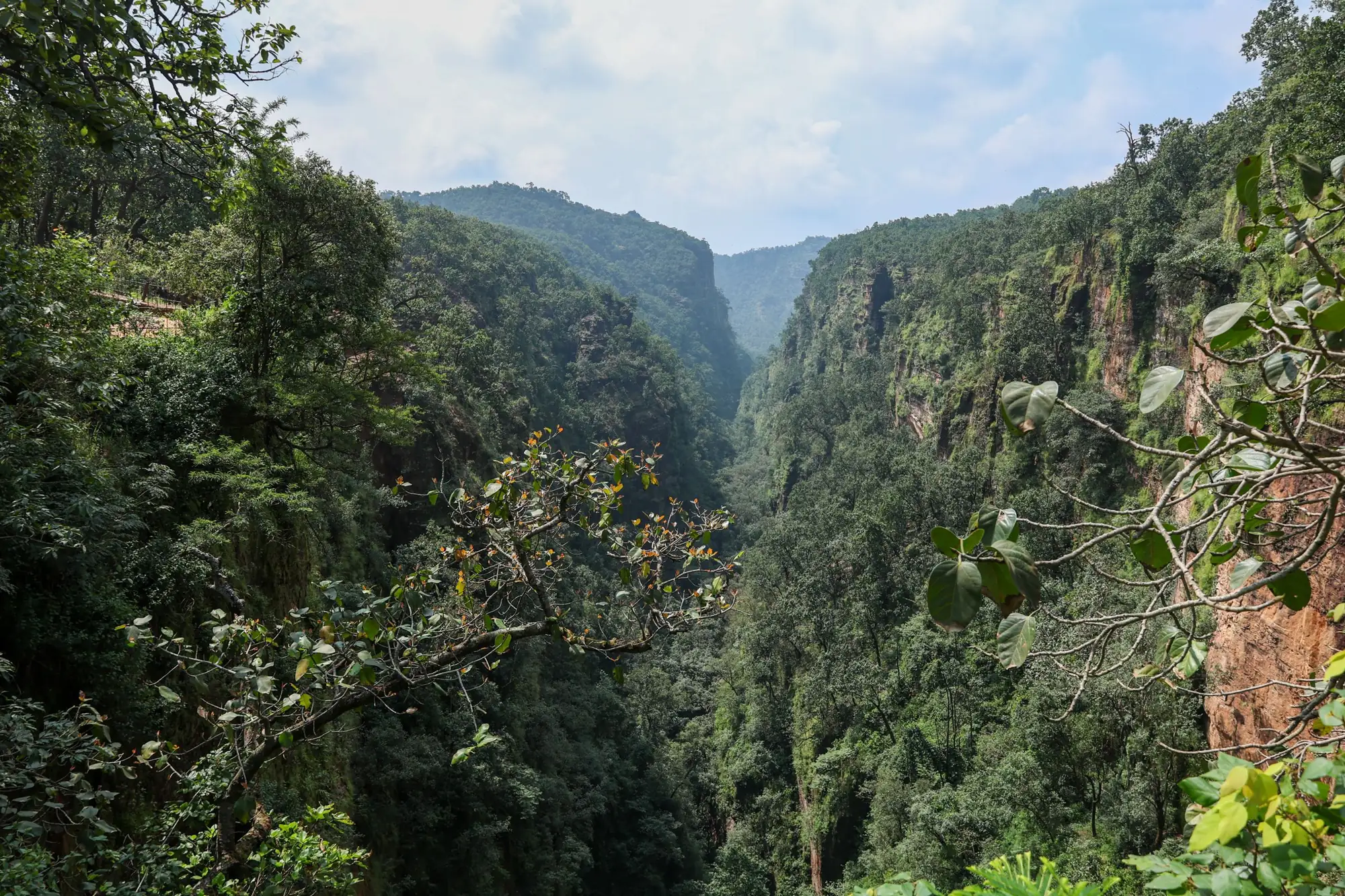
A forested sandstone gorge in Pachmarhi under a cloudy sky

Region 07 / 08Satpura ki Rani: the sandstone plateau of central India

Satpura–Pachmarhi

Cave shrines and rock-art shelters thousands of years old, cold forest pools, ravine waterfalls and the sal forests of the Satpura Tiger Reserve, from the 1,352 m crown of Madhya Pradesh down to the Denwa river and the hidden valley of Patalkot.

Routes
4
Days
3–7
Highest point
1,352 m
Grades
Moderate–Difficult

The routes4 routes

Satpura–Pachmarhi

Satpura ki Rani: the sandstone plateau of central India

  1. 01Themed routeJambudweep & Jalawataran: Hidden Pools of the PlateauThree days on foot below the plateau rim: Jata Shankar, the painted shelters of Jambudweep, Twynam Pool and the steep descent to Duchess Fall and Sunder Kund.Moderate3 days · 1,310 mRegister interest
  2. 02Themed routeMahadeo Hills Shrine Trail: Pansy Pool, Nandigarh & ChauragarhThe hard way to Pachmarhi's sacred summits: Patharchatta gorge and Pansy Pool, the Nandigarh tabletop, and a pre-dawn climb up the steps to Chauragarh for sunrise.Difficult3 days · 1,352 mRegister interest
  3. 03Themed routePachmarhi to Patalkot: Caves, Falls & the Doodhi GorgeTwo days among Pachmarhi's ravine shrines and falls, the Chhota Mahadev cave at Tamia, then three days walking down into Patalkot along the Doodhi.Moderate7 days · 1,080 mRegister interest
  4. 04Themed routeSatpura Deep: From the Plateau Shrines to the Denwa RiverPachmarhi's ancient caves, Chauragarh, the little-known Vijay Prapat, a camp-out on the Forsyth trail, the Sangam pools, then the Denwa backwaters at Madhai.Difficult7 days · 1,308 mRegister interest

Route 01 / 04SATPURA–PACHMARHI · CAVE SHRINE · ROCK ART · POOLS

Jambudweep & Jalawataran: Hidden Pools of the Plateau

Three days on foot below the plateau rim: Jata Shankar, the painted shelters of Jambudweep, Twynam Pool and the steep descent to Duchess Fall and Sunder Kund.

Moderate3 daysCave temple · Rock art · Pools · Falls

Season · Oct–Mar (falls fullest Oct–Nov)

Dates & batchesRegister Your Interest

The route

A boulder-cave Shiva shrine where a stream is born, painted rock shelters thousands of years old, and three cold forest pools most visitors never reach.

On foot
31 km
Total ascent
~310 m
Highest point
1,310 m
Nights
2 stay
Road transfer
108 km
Start / end
Pipariya

Pachmarhi's famous sights are reached by Gypsy in a few hours; its quiet ones need legs. This route walks the Jambudweep valley from the Jata Shankar cave, past rock shelters painted with hunters, animals and battle scenes, to Twynam Pool and the Chhota Mahadeo spring. The last day drops 200 m through forest to the base of Jalawataran (Duchess Fall) and on to Sunder Kund: a deep rock pool reached by crossing the stream on foot. Short days, cold water, ancient walls.

Highlights: up close

  1. 01

    Jata Shankar cave

    A Shiva shrine in a ravine under giant sandstone boulders; the rock above the entrance looks like matted locks, and the Jambu Dwip stream rises inside.

  2. 02

    Painted shelters of Jambudweep

    Six shelters on the valley's north side painted with animals, figures and a battle scene; Harper's Cave shows a harp player: a gallery few visitors find.

  3. 03

    Twynam Pool & Chhota Mahadeo

    A natural forest swimming pool, then a narrow sacred cleft where a spring cascades from overhanging rock.

  4. 04

    Jalawataran & Sunder Kund

    A steep, strenuous descent to the first cascade of Duchess Fall, then across the stream to a large rock pool deep enough to swim.

Day by day

  1. Day 1Pachmarhi outskirts → Jambudweep rock shelters
  2. Day 2Twynam Pool → Forest-edge homestay
  3. Day 3Astachal viewpoint → Climb out to road

Champion point · uncommonly visited

Sunder Kund

A large rock pool 2.5 km south-west of Duchess Fall, reached by crossing the stream and following a footpath: deep enough to swim and far enough below the plateau that the Gypsy tours never reach it.

Where the trail stays wild

Pipariya is the railhead only; Pachmarhi (cantonment town, ≈12,000) is used as the base at its forest edge: trails leave the houses within a kilometre and no other settlement is passed.

Stay options

  • Pachmarhi bungalow homestay or heritage lodge (colonial-era cottages): both nights; local Gond-style dinner on night 2.
  • Fallback: MP Tourism property in Pachmarhi for larger batches.

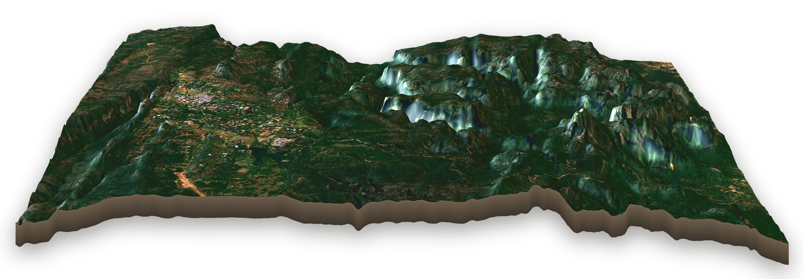
The route on the mountain Water waypoints Champion point Trail Road transfer
Oblique satellite view of the Jambudweep & Jalawataran: Hidden Pools of the Plateau area, looking north-west, with the route's waypoints marked
1Pachmarhi outskirts (forest-edge base), 1,067 m, at km 0 and 19
2Jata Shankar cave, 1,050 m, at km 3.5
3Jambudweep rock shelters, 1,067 m, at km 7
4Twynam Pool, 1,060 m, at km 13
5Chhota Mahadeo spring, 1,110 m, at km 16
6Astachal viewpoint, 1,310 m, at km 25
7Duchess Fall, 870 m, at km 28
8Sunder Kund pool, 860 m, at km 31
  1. 1Pachmarhi outskirts (forest-edge base)1,067 m · km 0, 19
  2. 2Jata Shankar cave1,050 m · km 3.5
  3. 3Jambudweep rock shelters1,067 m · km 7
  4. 4Twynam Pool1,060 m · km 13
  5. 5Chhota Mahadeo spring1,110 m · km 16
  6. 6Astachal viewpoint1,310 m · km 25
  7. 7Duchess Fall870 m · km 28
  8. 8Sunder Kund pool860 m · km 31
0 km · Pachmarhi outskirts (forest-edge base)31 km on foot · 860–1,310 m

Real terrain, looking north-west, heights ×1.5 so the low relief reads: SRTM elevation, imagery contains modified Copernicus Sentinel data 2025. Trail line indicative.

Route 02 / 04SATPURA–PACHMARHI · HILLTOP TEMPLES · GORGE POOL

Mahadeo Hills Shrine Trail: Pansy Pool, Nandigarh & Chauragarh

The hard way to Pachmarhi's sacred summits: Patharchatta gorge and Pansy Pool, the Nandigarh tabletop, and a pre-dawn climb up the steps to Chauragarh for sunrise.

Difficult3 daysHilltop temples · Cave shrines · Gorge pool

Season · Oct–Mar (avoid Shivratri & Nag Panchami)

Dates & batchesRegister Your Interest

The route

Three days on the pilgrim trails of the Mahadeo Hills: a ladder-scaled Nandi temple, a summit shrine forested with tridents, and a pool hidden in a 100 m gorge.

On foot
34 km
Total ascent
~668 m
Highest point
1,352 m
Nights
2 stay
Road transfer
149 km
Start / end
Pipariya

Outside the two great festivals these old pilgrim paths are almost empty. Day one drops into the Patharchatta gorge, 100 m walls split by a stream, to Pansy Pool among the ferns. Day two leaves the Bada Mahadev cave through Nadia village and teak-and-sal buffer forest to Nandigarh, a tabletop hill climbed by an iron ladder to its Nandi temple. Day three starts in the dark: more than 1,300 steps to Chauragarh's summit shrine, its slopes bristling with tridents left by pilgrims, for sunrise over the Satpuras.

Highlights: up close

  1. 01

    Patharchatta & Pansy Pool

    A narrow stream gorge between 100 m rock walls, ending at a shaded fern pool on the Denwa headwaters.

  2. 02

    Nandigarh

    A tabletop hill in the reserve's buffer, climbed by an iron ladder to a small Nandi temple with long views over teak and sal.

  3. 03

    Chauragarh at sunrise (1,308 m)

    Over 1,300 steps to a summit Shiva shrine whose slopes hold hundreds of iron tridents offered by pilgrims.

  4. 04

    Bada & Gupt Mahadev

    A vast dripping rock-cut cave and a narrow secret cave shrine: the heart of the Mahadeo legend.

Day by day

  1. Day 1Pachmarhi outskirts → Pansy Pool
  2. Day 2Nadia village → Forest-edge homestay
  3. Day 3Chauragarh summit shrine → Dhoopgarh

Champion point · uncommonly visited

Nandigarh (Nandi temple)

A tabletop hill in the reserve's buffer climbed by an iron ladder to a small Nandi temple: a pilgrim site crowded two days a year and empty the rest, reached by a 7 km walk from the Bada Mahadev cave through Nadia village.

Where the trail stays wild

Pipariya railhead only; Pachmarhi's forest edge is the base; Nadia is a Gond hamlet; no other settlement.

Stay options

  • Pachmarhi bungalow homestay: both nights; early breakfast packed for the pre-dawn Chauragarh start.
  • Fallback: forest-edge tented camp on the Pachmarhi outskirts (permitted operator).
The route on the mountain Water waypoints Champion point Trail Road transfer
Oblique satellite view of the Mahadeo Hills Shrine Trail: Pansy Pool, Nandigarh & Chauragarh area, looking east, with the route's waypoints marked
1Pachmarhi outskirts (forest-edge base), 1,067 m, at km 0 and 26
2Patharchatta gorge, 800 m, at km 5.5
3Pansy Pool (Vanshree Vihar), 1,067 m, at km 11
4Nadia village, 920 m, at km 16.5
5Nandigarh (Nandi temple), 1,080 m, at km 21.5
6Chauragarh summit shrine, 1,308 m, at km 31
7Gupt Mahadev cave, 1,140 m, at km 33.5
  1. 1Pachmarhi outskirts (forest-edge base)1,067 m · km 0, 26
  2. 2Patharchatta gorge800 m · km 5.5
  3. 3Pansy Pool (Vanshree Vihar)1,067 m · km 11
  4. 4Nadia village920 m · km 16.5
  5. 5Nandigarh (Nandi temple)1,080 m · km 21.5
  6. 6Chauragarh summit shrine1,308 m · km 31
  7. 7Gupt Mahadev cave1,140 m · km 33.5
0 km · Pachmarhi outskirts (forest-edge base)33.5 km on foot · 800–1,308 m

Real terrain, looking east, heights ×1.5 so the low relief reads: SRTM elevation, imagery contains modified Copernicus Sentinel data 2025. Trail line indicative.

Route 03 / 04SATPURA–PACHMARHI · CAVE TEMPLES · GORGE · TRIBAL VALLEY

Pachmarhi to Patalkot: Caves, Falls & the Doodhi Gorge

Two days among Pachmarhi's ravine shrines and falls, the Chhota Mahadev cave at Tamia, then three days walking down into Patalkot along the Doodhi.

Moderate7 daysCave temples · Waterfalls · River gorge

Season · Oct–Feb

Dates & batchesRegister Your Interest

The route

From the cave shrines and falls of Pachmarhi to Patalkot: a horseshoe valley sunk into the Satpuras where the Doodhi river runs past Bharia villages.

On foot
46 km
Total ascent
~634 m
Highest point
1,080 m
Nights
4 stay, 2 camp
Road transfer
374 km
Start / end
Pipariya / Nagpur

Patalkot, 'the deep place', is a 79 km² horseshoe valley below the cliffs of Tamia, where Bharia and Gond families have lived for centuries. This route links it to Pachmarhi. Start with Jata Shankar and the painted Jambudweep shelters, drop to Duchess Fall and Sunder Kund, then cross to Tamia and its forest cave temple. From the rim at Chimtipur you walk into the gorge: a log bridge at Mandawali, the confluence of the Gayani and Doodhi, the Raja Khoh cave shrine, the Gyani waterfall and nights at the edge of tribal villages, then climb out to the cliff-top for the whole valley at your feet.

Highlights: up close

  1. 01

    Jata Shankar & Duchess Fall

    A boulder-cave Shiva shrine at a stream's source, and a steep forest descent to the first cascade of Jalawataran and the Sunder Kund pool.

  2. 02

    Chhota Mahadev, Tamia

    A cave temple in the woods below Tamia's cliffs: a short, quiet hike from the plateau village.

  3. 03

    Raja Khoh & the confluence

    A rock-shelter cave with a small Shiva shrine, linked by local legend to a Bhonsle king who hid in Patalkot from the British, near the meeting of the Gayani and Doodhi.

  4. 04

    Patalkot from the cliff-top

    The whole horseshoe valley below you after the climb out from Kareyam: river, forest and scattered villages in one view.

Day by day

  1. Day 1Pachmarhi outskirts → Forest-edge homestay
  2. Day 2Duchess Fall → Forest-edge homestay
  3. Day 3Tamia → Chhota Mahadev cave, Tamia
  4. Day 4Chimtipur → Chikla Rasta camp
  5. Day 5Gayani–Doodhi confluence → Kareyam village camp
  6. Day 6Gyani waterfall → Tamia
  7. Day 7Nagpur

Champion point · uncommonly visited

Raja Khoh cave shrine

A rock-shelter cave with a small Shiva shrine in the Doodhi gorge, tied by local legend to a Bhonsle king who hid in Patalkot from the British, reached only on foot along the river, a day from any road.

Where the trail stays wild

Pipariya and Nagpur are hubs only; Pachmarhi's forest edge is the base; Tamia is a small hill village; Patalkot's hamlets (Chimtipur, Kareyam) are tribal villages of a few hundred people.

Stay options

  • Pachmarhi bungalow homestay (nights 1–2); Tamia forest/PWD rest house or local homestay (nights 3 and 6).
  • Patalkot camps at Chikla Rasta and Kareyam (nights 4–5), pitched with village permission; Bharia hosts cook.
The route on the mountain Water waypoints Champion point Trail Road transfer
Oblique satellite view of the Pachmarhi to Patalkot: Caves, Falls & the Doodhi Gorge area, looking north, with the route's waypoints marked
1Pachmarhi outskirts (forest-edge base), 1,067 m, at km 0 and 6 and 18
2Jata Shankar & shelters, 1,050 m, at km 3
3Duchess Fall, 870 m, at km 12
4Sunder Kund pool, 860 m, at km 15
5Tamia, 975 m, at km 20 and 46
6Chhota Mahadev cave, Tamia, 950 m, at km 22
7Chimtipur (rim), 787 m, at km 24.5
8Mandawali log bridge, 673 m, at km 27.5
9Chikla Rasta camp, 560 m, at km 30
10Gayani–Doodhi confluence, 640 m, at km 38
11Raja Khoh cave shrine, 630 m, at km 39
12Kareyam village camp, 620 m, at km 40
13Gyani waterfall, 780 m, at km 42
14Kareyam cliff-top, 890 m, at km 44
  1. 1Pachmarhi outskirts (forest-edge base)1,067 m · km 0, 6, 18
  2. 2Jata Shankar & shelters1,050 m · km 3
  3. 3Duchess Fall870 m · km 12
  4. 4Sunder Kund pool860 m · km 15
  5. 5Tamia975 m · km 20, 46
  6. 6Chhota Mahadev cave, Tamia950 m · km 22
  7. 7Chimtipur (rim)787 m · km 24.5
  8. 8Mandawali log bridge673 m · km 27.5
  9. 9Chikla Rasta camp560 m · km 30
  10. 10Gayani–Doodhi confluence640 m · km 38
  11. 11Raja Khoh cave shrine630 m · km 39
  12. 12Kareyam village camp620 m · km 40
  13. 13Gyani waterfall780 m · km 42
  14. 14Kareyam cliff-top890 m · km 44
0 km · Pachmarhi outskirts (forest-edge base)46 km on foot · 560–1,067 m

Real terrain, looking north, heights ×1.5 so the low relief reads: SRTM elevation, imagery contains modified Copernicus Sentinel data 2025. Trail line indicative.

Route 04 / 04SATPURA–PACHMARHI · CAVES · HIDDEN FALLS · TIGER FOREST

Satpura Deep: From the Plateau Shrines to the Denwa River

Pachmarhi's ancient caves, Chauragarh, the little-known Vijay Prapat, a camp-out on the Forsyth trail, the Sangam pools, then the Denwa backwaters at Madhai.

Difficult7 daysAncient caves · Hidden falls · Riverside camp

Season · Oct–Mar (reserve camps open Oct–Jun)

Dates & batchesRegister Your Interest

The route

From ancient cave dwellings and summit shrines down through sal forest to a riverside camp inside the tiger reserve, ending in a dawn canoe on the Denwa.

On foot
54 km
Total ascent
~1,009 m
Highest point
1,308 m
Nights
5 stay, 1 camp
Road transfer
336 km
Start / end
Pipariya / Bhopal

Satpura is one of the few tiger reserves where you may walk. This route uses that privilege. It begins at the Pandav caves and Bee Fall pools, climbs Chauragarh, and pushes to Vijay Prapat: a waterfall in deep forest few trekkers see. Then it drops off the plateau on the path Captain James Forsyth explored in 1857, camping by the river at Dehaliya and bathing in the Denwa's pools at the Sangam. The last day is spent at the reserve's river edge at Madhai: on foot with a forest guide and by canoe at dawn.

Highlights: up close

  1. 01

    Pandav caves

    Five ancient dwellings cut into a low sandstone hill: the protected caves that, by legend, give Pachmarhi its name.

  2. 02

    Vijay Prapat

    A waterfall at the end of a rugged jungle route: among the least visited in the Satpuras, cool even in April.

  3. 03

    Dehaliya riverside camp

    A sanctioned eco-camp inside the reserve on the Forsyth trail: river sounds, a campfire and a dark sky full of stars.

  4. 04

    The Sangam & the Denwa

    Bathing pools where streams meet below the plateau, then the wide Denwa at Madhai, walked with a forest guide and paddled at dawn.

Day by day

  1. Day 1Pachmarhi outskirts → Forest-edge homestay
  2. Day 2Mahadev caves → Forest-edge homestay
  3. Day 3Vijay Prapat → Forest-edge homestay
  4. Day 4Naka trailhead → Dehaliya riverside camp
  5. Day 5Sangam, Denwa pools → Forest-edge homestay
  6. Day 6Madhai → Denwa riverbank
  7. Day 7Dawn canoe on the Denwa → Bhopal

Champion point · uncommonly visited

Vijay Prapat

A waterfall at the end of a rugged jungle route off the Pachmarhi plateau, cool even in April and among the least visited falls in the Satpuras, reached on foot, with a guide, and by almost nobody else.

Where the trail stays wild

Pipariya and Bhopal are hubs only; Pachmarhi's forest edge is the base; Dehaliya is a camp; Madhai is a reserve-gate hamlet with lodges.

Stay options

  • Pachmarhi bungalow homestay: nights 1–3 and 5.
  • Dehaliya eco-camp inside the reserve (night 4) via a permitted operator; Madhai riverside lodge or village homestay at the reserve edge (night 6).
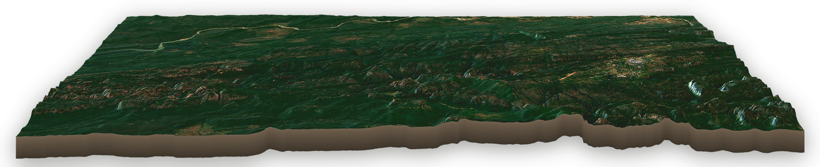
The route on the mountain Water waypoints Champion point Trail Road transfer
Oblique satellite view of the Satpura Deep: From the Plateau Shrines to the Denwa River area, looking north, with the route's waypoints marked
1Pachmarhi outskirts (forest-edge base), 1,067 m, at km 0 and 6 and 13 and 23 and 49
2Pandav caves & Bee Fall, 1,134 m, at km 3
3Mahadev caves, 1,244 m, at km 7
4Chauragarh summit shrine, 1,308 m, at km 8.5
5Vijay Prapat (hidden fall), 930 m, at km 18
6Naka trailhead, 883 m, at km 27.5
7Kanjighat river, 767 m, at km 31.5
8Dehaliya riverside camp, 440 m, at km 36
9Sangam, Denwa pools, 390 m, at km 42.5
  1. 1Pachmarhi outskirts (forest-edge base)1,067 m · km 0, 6, 13, 23, 49
  2. 2Pandav caves & Bee Fall1,134 m · km 3
  3. 3Mahadev caves1,244 m · km 7
  4. 4Chauragarh summit shrine1,308 m · km 8.5
  5. 5Vijay Prapat (hidden fall)930 m · km 18
  6. 6Naka trailhead883 m · km 27.5
  7. 7Kanjighat river767 m · km 31.5
  8. 8Dehaliya riverside camp440 m · km 36
  9. 9Sangam, Denwa pools390 m · km 42.5
0 km · Pachmarhi outskirts (forest-edge base)54 km on foot · 360–1,308 m

Real terrain, looking north: SRTM elevation, imagery contains modified Copernicus Sentinel data 2025. Trail line indicative.

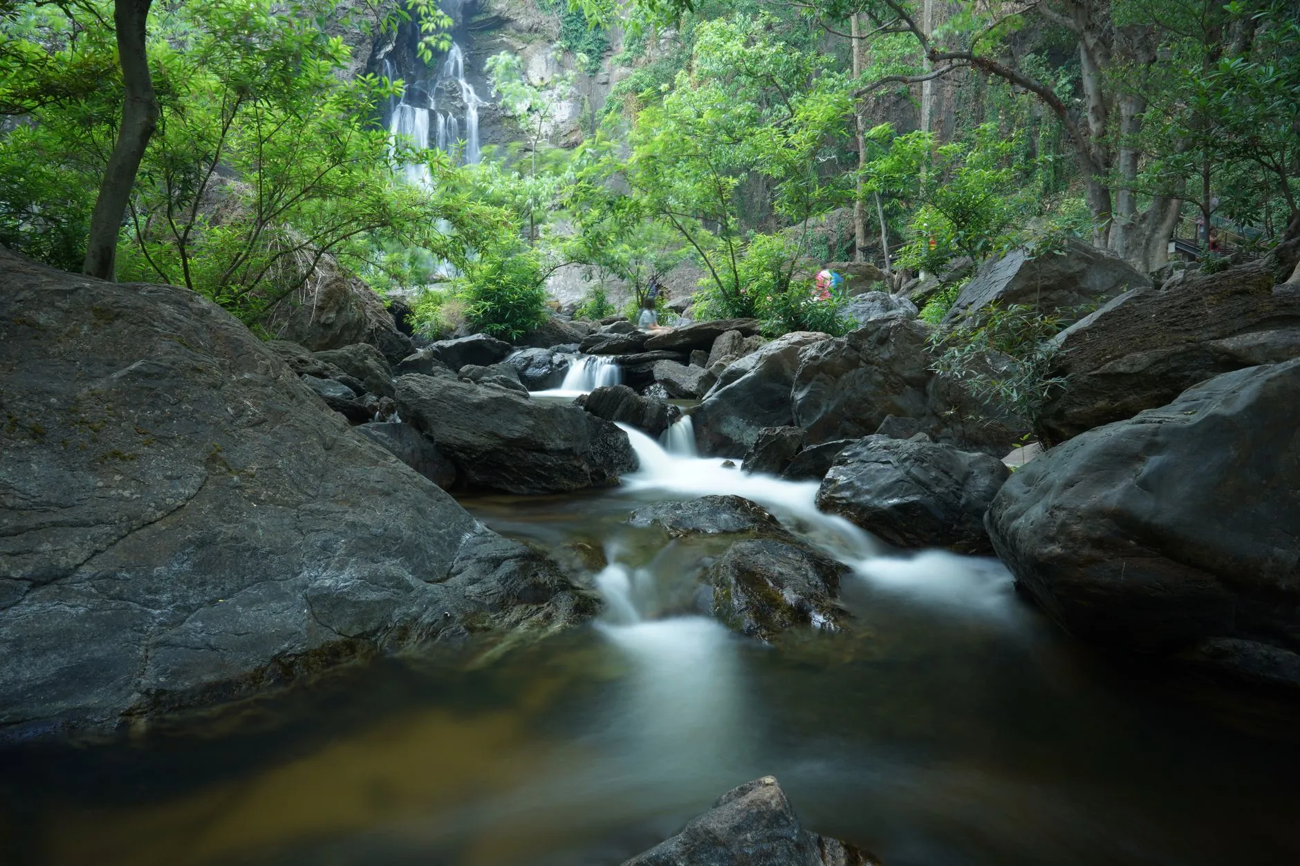
A forest stream cascading over rocks

Your Next Hike Awaits

Come Back Different.

Small batch. Led by Veterans from the Special Forces of Indian Army. Skills you keep for life. Reserve your place on an off-beat trail this season.